Do Atmospheric Rivers Bring Floods or Help End Droughts?
Atmospheric rivers carry vapor that can replenish rain and snow, while strong, slow-moving events can flood vulnerable watersheds. A 2010 West Coast case shows why benefits and hazards depend on place and timing.
Publication & corrections: infostoa · Editorial standards
Individual author and specialist reviewer information is not provided for this article.
An atmospheric river is a long, narrow corridor that transports concentrated water vapor through the atmosphere. When it reaches land, the vapor can fall as rain or snow and contribute to water supplies. Yet a very moist, windy flow that stalls over a flood-prone watershed can also cause damage. The name alone does not tell us whether an event will help or harm. NOAA compares the average atmospheric river’s vapor transport with the average flow at the mouth of the Mississippi; exceptionally strong cases may carry up to 15 times as much. This comparison converts vapor mass to liquid-water volume. It is not a forecast of local rainfall or flooding. NOAA
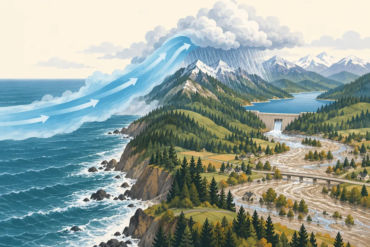
A corridor of atmospheric moisture
An atmospheric river is not a surface river with banks. It is a concentrated region of water vapor, and its length, width, and strength vary. Moisture can travel from tropical areas toward higher latitudes. A strong flow that carries moisture from near Hawaii toward the U.S. West Coast is sometimes called the “Pineapple Express,” but that nickname does not describe the origin or intensity of every event.
At landfall, temperature, terrain, and rising air help determine whether moisture condenses as rain or snow. One flow can bring rain to lower windward slopes and snow to higher elevations. Water that runs into streams immediately, infiltrates soil, or remains in snowpack has different effects and timing. Total vapor transport through the atmosphere is not the same as precipitation measured over an individual watershed.
Why water supply and flooding can occur together
Precipitation can replenish reservoirs, soil, and snowpack. NOAA notes that weaker atmospheric rivers often provide rain or snow important to water supplies. At the other extreme, events with very large vapor amounts and strong winds can produce extreme rainfall. If a flow stalls over a flood-prone watershed, inundation and landslide risks can rise. Outcomes depend on rainfall intensity and duration, prior soil wetness, drainage, and river conditions—not just the event’s label.
A large rainfall total alone does not establish the net effect on water supply. Rain can run off quickly and cause damage, while snow stores water until it melts. Seasonal storage and immediate flood danger operate on different timescales and need to be considered together. These are general mechanisms; a local reservoir estimate or flood outlook requires local observations and forecasts.
What two 2010 West Coast atmospheric-river events show
The Scripps Institution of Oceanography’s Center for Western Weather and Water Extremes (CW3E) discusses researcher Mike Dettinger’s work on atmospheric rivers and drought relief. CW3E describes two atmospheric-river events affecting the West Coast in January 2010, after which the area classified as moderate or severe drought across the U.S. West was greatly reduced. Some locations recorded more than 20 inches of precipitation in this case. This case shows drought relief, not that every atmospheric river ends drought. CW3E, Scripps
Drought is not defined by one rainfall total. Soil moisture, snowpack, reservoir storage, evaporative demand, and precipitation in earlier seasons also shape water availability. A short-term improvement in indicators cannot be generalized into a lasting end to water scarcity or a guarantee that every watershed is safe. CW3E summarizes a specific study and event; local effects require separate assessment.
Questions for forecasts and local decisions
An assessment considers vapor transport along with a storm’s path, speed, and landfall timing. A strong flow that passes quickly can produce a different accumulation from one affecting the same watershed for days. In mountain regions, wind direction and temperature by elevation also shift the rain–snow distribution. Weather agencies combine numerical forecasts with satellite, radar, and precipitation observations to produce local guidance.
It is useful to separate two questions: “Could stored water increase?” and “When and where could danger rise?” The first calls for reservoir, snowpack, soil, and long-term water-management information. The second calls for time-specific rainfall forecasts and river or landslide alerts. Neither a nickname nor an average transport comparison determines an individual’s flood exposure or a region’s water outlook.
Expert perspective: the same flow, different outcomes
The Dettinger work highlighted by CW3E describes an atmospheric-river event that helped ease drought in the West. NOAA adds that strong, persistent events can cause floods and landslides, while many weaker ones provide useful rain and snow. These points are compatible: one describes a specific water-relief case; the other describes a range of effects across different events and watersheds.
When reading expert analysis, check the period and area covered by precipitation and drought measures, whether water fell as rain or snow, and how wet the watershed was beforehand. Treating one rainfall total as a proxy for either water-supply benefit or damage hides terrain, storage, and timing. Atmospheric rivers are important pathways in the water cycle, but their effects depend on local conditions.
Sources
- NOAA, “What are atmospheric rivers?” — definition, transport scale, water-supply benefits, and flood risks.
- CW3E, “Atmospheric Rivers: Drought Busters” — Mike Dettinger’s work and the January 2010 West Coast case.